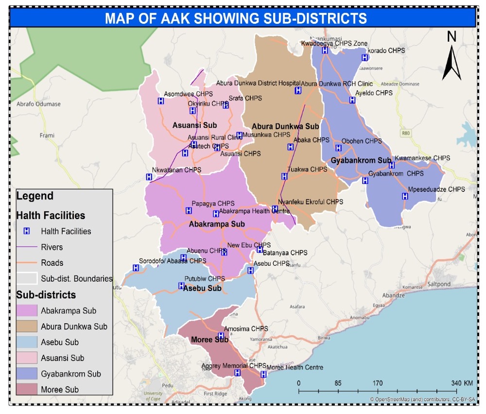
Background
Abura Asebu Kwamankese District (AAK) shares boundaries with Assin South in the North, Twifo Heman Lower Denkyira in the Northwest, Cape Coast District in the Southwest and the Mfantsiman District in the East. The projected population for year 2024 is 133,606. The District is predominantly rural. The inhabitants are mainly farmers (Abura and Kwamankese traditional areas) and fishing along the coast (Moree, Asebu Traditional Area). The main language spoken is Fante. The A.A.K. District is one of the most deprived districts in the Central Region and is situated in a wet semi-equatorial climatic region. The original vegetation is moist semi-deciduous rain forest. There are two rainy seasons, the main from April to July and the minor from September to November.
Accessibility
The Cape Coast – Kumasi trunk road, which was completed in 1993, has improved accessibility to the district from other parts of the country. The feeder roads into the various part of the district are not tarred and many are in deplorable state. Most third class road leading to the communities from the district are inaccessible during the rainy season.
District Health System
Health services in the District are provided by different sectors; traditional (orthodox), spiritual, the government and private health institutions. The District has the largest prayer camp in the whole of Central Region at Edumfa where people from all walks of life do come for spiritual healing and revivals. Almost every community has a prayer camp too called GARDEN or AWOYO which seems to be their first point of contact when one is sick/ill.
There are 37 health facilities in the district which includes; 1 district hospital, 2 health centers, 1 clinic, 1 reproductive centre and 32 CHPS zones.


